

This article describes the best methods to help find additional data sources when looking for historical weather data in remote locations.
This article uses the weather data query builder to construct a query to request past weather and to view data and maps to help find data.
Step one – check that your location address is correct
The first step in finding historical weather data is to run a query for a specified location. The location can be specified as an address or as a latitude, longitude value. It is very important that these locations are submitted correctly. Common problems include not specifying a precise enough address (if you use a city name for example there are many cities with the same name) or reversing the latitude and longitude values.
If you are trying to learn more about data that seems to be wrong, you will first want to check the map of the requested location.
For our demonstration, we will use the location with latitude 48.5, longitude -127.5. This is an ocean location off the coast of the Western USA. When we enter the location in the query builder and click on the Stations data button, we can see a map on the query page of the requested location:
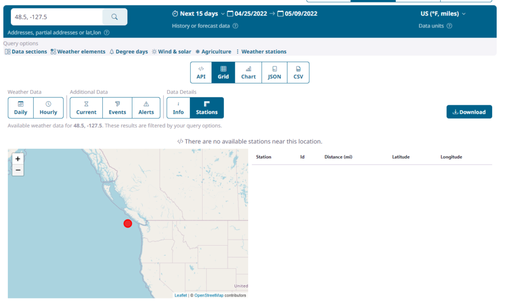
We can see that there are no weather stations found for the current weather query.
For more information on how we combine weather station observations into a single location, see our article on how we interpolate past weather observations.
Step two – extend the weather station search radius to find additional weather stations.
As we can see in our example, there are no weather stations found near the above location. By default, queries will search for weather stations up to 50 kilometers or 50 miles from the requested location (based on your chosen units system). This value can be extended to up to 200km (about 125 miles) using the ‘maximum distance’ setting. This setting is available in the query builder or the API request. To set this in the query builder, click on the Query Options->Weather Stations link at the top of the page:

This displays the weather station options:
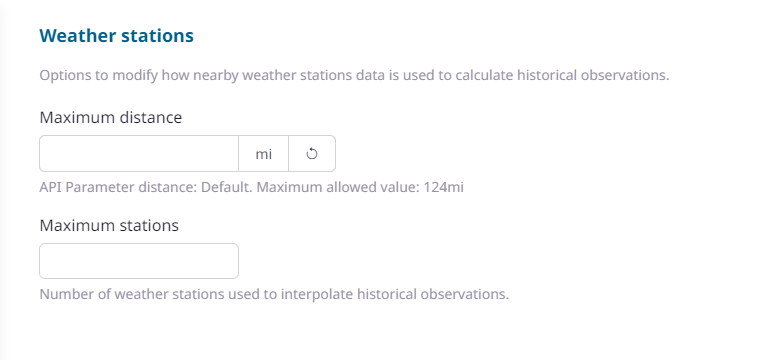
An empty or blank value for ‘maximum distance’ indicates that the query will use the default value of 50km or 50 miles depending on the unit group selected.
We can extend this to 100miles by entering 100 in the box and hitting apply. The station information now includes stations:
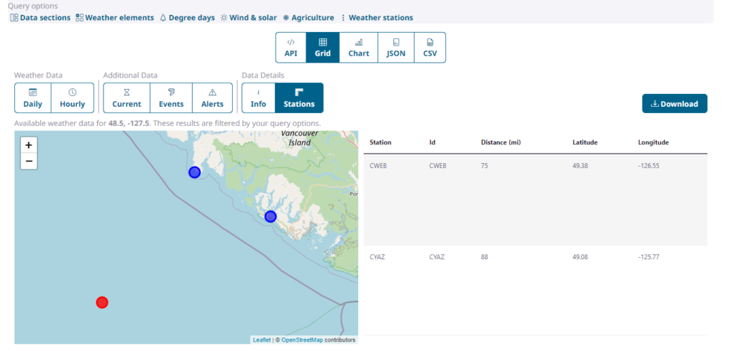
This shows that two weather stations were found with the new, extended maximum search distance.
Step three – using remote data sources
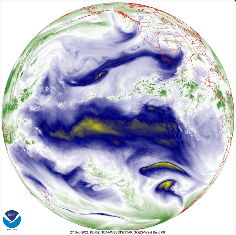
If no weather data is found even when extending the search radius, then there are no weather stations near to the requested location. In this case we can look to remote weather data. Remote datasets include satellite and radar observations. Remote data sets are able to provide extremely high amounts of coverage because they do not require the presence a physical measuring station at a particular location.
If you are requesting data from mid-January 2022 onwards, the data will automatically include remote data sources if no local weather observations can be found. Prior to January 2022, it is necessary to explicitly include remote in your request. Currently this data can only be included in a Weather API request. This can be done using the ‘useremote’ API option:
https://weather.visualcrossing.com/VisualCrossingWebServices/rest/services/timeline/London,UK/2021-02-15?&key=YOUR_API_KEY&contentType=csv&include=hours&options=useobs,useremote
For full information on using remote data, please see Using remote data sources in the Weather API.
Questions or need help?
If you have a question or need help, please post on our actively monitored forum for the fastest replies. You can also contact us via our support site or drop us an email at support@visualcrossing.com.